Linda, Listen.
UPDATE 2 (3:30am, Sept 15): The rain has begun in earnest. This is a tropical downpour; the air is soup - dew points are close to 70F and the air temperature is around 72F. Doppler radar indicates moderate to heavy showers spreading completely into Ventura and Los Angeles counties. The National Weather Service has issued a flood advisory for the morning rush hour for probable ponding and slick roadways (it hasn't rained since July!) and the chance of minor mud/debris flows in the recent burn areas (looking at you, Sierra Madre). Be careful out there and enjoy this very rare and unusual warm early autumn downpour.
UPDATE (5:30pm, Sept 14): Rain showers are now showing up on radar offshore (see image to the right). These should begin moving onshore later this evening.
Below I've attached an animated gif that I made of the most recent high-resolution model forecast radar from 10pm through 7am showing a nice slug of rain moving onshore during the overnight and ending probably around daybreak. :)
Visible satellite image at 8:30am Monday, September 14
Precipitation Water (PWAT) forecast for 1am Tuesday, September 15
Original post: The remnants of former Hurricane Linda are swirling around in the Pacific ocean off our coast. You can see them on the visible satellite image from this morning (to the right) that I have annotated. The dashed line represents a broad upper-level "trough" which, combined with a weak upper level jet streak is providing what we call "lift". That is, the atmospheric dynamics are helping to "lift" the moisture from Linda up and in to Southern California as rain (probably). The arrow represents the general flow of air out ahead of the advancing trough. As the trough gets closer to LA we should see moisture from Linda get entrained in the large-scale flow, some slight advective enhancement due to favorable upper-level dynamics, and all indications are for a rain event sometime this evening into tomorrow (Tuesday) morning.
The combination of Linda moisture + upper-level forcing should bring rain showers anywhere from Monterey down to San Diego - beginning later this afternoon (even this morning some light showers are falling in Santa Barbara/Ventura counties). Below I've attached an image of he precipitable water -- i.e. a measure of the amount of water in the air that could be turned into rain -- forecast for tonight at 1am and you can see a narrow tongue of blue (and yellow) directed right at Los Angeles which indicates very moist tropical air. With just enough "lift", this moisture should get wrung out in the form of showers.
How much rain are we talking?
These types of storms are very difficult to predict. Models have a hard time dealing with moisture surging up from the south like this. We could end up getting a LOT of rain, or we could end up with a few lame showers. It's really hard to say right now. The latest model output shows anywhere from 0.1 - 0.5" of rain (with more in the mountains and foothills due to orographics) in the 48 hour period ending 4am Wednesday, but again, these estimates are NOT set in stone.
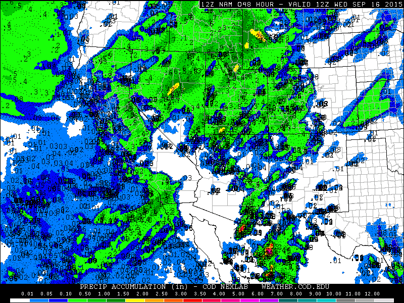
Forecast total precipitation for the 48 hours ending 4am Wednesday. (Model = NAM/WRF)
As usual - stay tuned for updates. I'll be updating at the top of this post :)